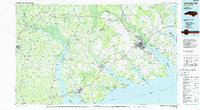
1985 Map of Elizabeth City
USGS Topo · Published 1985About this map
The Pasquotank River and Chowan River dominate this coastal landscape as they empty into the Albemarle Sound in the mid-1980s. This survey illustrates the intricate relationship between the region's dense wetlands and its human settlements, with the Great Dismal Swamp stretching across the northern border and Merchants Millpond State Park preserved to the west. Centers of local commerce and navigation like Elizabeth City and Edenton serve as anchors for the surrounding rural counties.
Find a feature on this map
252 named features on this map. Tap any name to fly to it.
Don’t see what you’re looking for? This feature index may not catch every label — zoom into the map to look around manually.
Map Details
Editions of this 1985 Elizabeth City Map
2 editions found
Other maps of this area

1893 · Virginia Beach
USGS Topo · 1:125,000

1901 · Williamston
USGS Topo · 1:62,500

1902 · Williamston
USGS Topo · 1:62,500

1904 · Edenton
USGS Topo · 1:62,500

1906 · Hertford
USGS Topo · 1:62,500

1906 · Beckford
USGS Topo · 1:48,000

1907 · Beckford
USGS Topo · 1:62,500

1908 · Winton
USGS Topo · 1:62,500

1916 · Back Bay
USGS Topo · 1:62,500

1919 · Suffolk
USGS Topo · 1:62,500