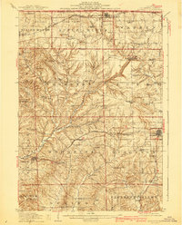
1911 Map of Elizabeth
USGS Topo · Published 1940About this map
Charles Mound stands at the northern edge of this Jo Daviess County landscape, part of an undulating terrain defined by prominent mounds and the branching valleys of the Apple River. In the early twentieth century, this region was a busy network of dairy farms and lead mining, served by two major rail lines. The Chicago Great Western RR cuts through the center via Woodbine and Stockton, while the Illinois Central RR skirts the northern boundary near Apple River station and Laws Siding.
Find a feature on this map
79 named features on this map. Tap any name to fly to it.
Don’t see what you’re looking for? This feature index may not catch every label — zoom into the map to look around manually.
Map Details
Editions of this 1911 Elizabeth Map
2 editions found
Other maps of this area

1892 · Savanna
USGS Topo · 1:62,500

1902 · Mineral Point
USGS Topo · 1:125,000

1911 · Elizabeth
USGS Topo · 1:62,500

1911 · Galena
USGS Topo · 1:62,500

1913 · Galena
USGS Topo · 1:62,500

1923 · South Wayne
USGS Topo · 1:62,500

1935 · Miles
USGS Topo · 1:62,500

1936 · Elizabeth
USGS Topo · 1:62,500

1937 · Lena
USGS Topo · 1:48,000

1941 · Miles
USGS Topo · 1:62,500