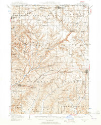
1936 Map of Elizabeth
USGS Topo · Published 1965About this map
The Apple River carves a deep valley through this northern Illinois landscape, which in the 1930s was defined by a dense network of family-run farms and country schoolhouses. This region of Jo Daviess County includes Charles Mound, the highest point in the state, standing among numerous named elevations like Squirrel Grove Mound and Benton Mound. The settlement pattern follows the tracks of the Chicago Great Western RR and the Illinois Central RR, with towns such as Elizabeth and Stockton serving as local hubs. Economic life is further illustrated by the presence of the Wishon Mine and Hagerty Mine near the western edge of the quadrangle. For those studying the social geography of the era, the map meticulously records dozens of local education sites, from the Sweet Home School to the Terrapin Ridge School, alongside the establishment of the Apple River Canyon State Park.
Find a feature on this map
91 named features on this map. Tap any name to fly to it.
Don’t see what you’re looking for? This feature index may not catch every label — zoom into the map to look around manually.
Map Details
Editions of this 1936 Elizabeth Map
2 editions found
Other maps of this area

1892 · Savanna
USGS Topo · 1:62,500

1902 · Mineral Point
USGS Topo · 1:125,000

1911 · Elizabeth
USGS Topo · 1:62,500

1911 · Galena
USGS Topo · 1:62,500

1913 · Galena
USGS Topo · 1:62,500

1923 · South Wayne
USGS Topo · 1:62,500

1935 · Miles
USGS Topo · 1:62,500

1936 · Elizabeth
USGS Topo · 1:62,500

1937 · Lena
USGS Topo · 1:48,000

1941 · Miles
USGS Topo · 1:62,500