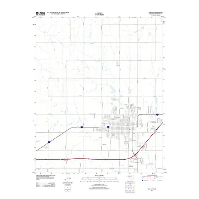
2012 Map of Elk City
USGS Topo · Published 2012About this map
Fairlawn Cem and several neighboring burial grounds including Calvary Cem and E Fairlawn Cem sit at the northern edge of the growing western Oklahoma hub. The 2012 landscape reflects the intensive grid development of the Southern Plains, where section roads like N Pioneer Rd and Merritt Rd define a geometric pattern of transit and land use. The urban center is flanked by a network of local waterways, including the drainage of Elk Cr and W Elk Cr to the south. Further out, rural landmarks like Grandview Cem and Merritt Cem mark the heritage of the surrounding Beckham County countryside. The infrastructure of the era is evident in the presence of the Elk City Regional Business Airport and the complex street grid that extends from the downtown core toward the surrounding prairie.
Find a feature on this map
122 named features on this map. Tap any name to fly to it.
Don’t see what you’re looking for? This feature index may not catch every label — zoom into the map to look around manually.
Map Details
Editions of this 2012 Elk City Map
This is the sole edition of this map. No revisions or reprints were ever made.
Other maps of this area

1955 · Clinton
USGS Topo · 1:250,000

1957 · Clinton
USGS Topo · 1:250,000

1960 · Cheyenne
USGS Topo · 1:62,500

1960 · Sayre
USGS Topo · 1:62,500

1960 · Hammon
USGS Topo · 1:62,500

1961 · Elk City
USGS Topo · 1:62,500

1984 · Foss Reservoir
USGS Topo · 1:100,000

1985 · Elk City
USGS Topo · 1:100,000

1987 · Big Kiowa Creek
USGS Topo · 1:24,000

1987 · Elk City
USGS Topo · 1:24,000