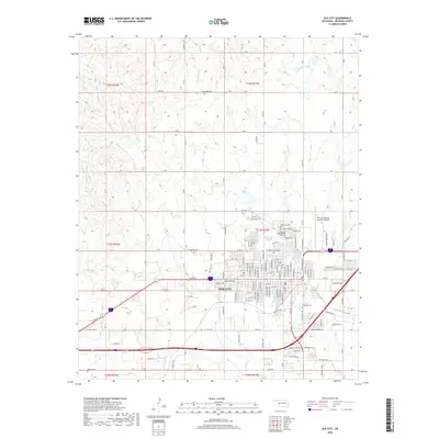
2018 Map of Elk City
USGS Topo · Published 2018About this map
Elk City serves as the primary urban center for this western Oklahoma landscape, where the flat, grid-iron layout of the town meets the rolling drainage basins of several local waterways. The municipal area is densely plotted with residential and commercial streets, including W Broadway Ave and Railroad Ave, reflecting its role as a regional hub for transportation and commerce. Outside the city limits, the terrain is defined by the winding paths of Big Kiowa Cr and White Shield Cr, which cut through the surrounding agricultural and ranching lands. This map is particularly valuable for genealogical research, identifying several distinct burial grounds such as Grandview Cem to the north and the clustered Fairlawn Cem, East Fairlawn Cem, and Calvary Cem on the town's eastern edge. To the south, the Elk City Regional Business Airport indicates the modern infrastructure supporting this prairie community.
Find a feature on this map
56 named features on this map. Tap any name to fly to it.
Don’t see what you’re looking for? This feature index may not catch every label — zoom into the map to look around manually.
Map Details
Editions of this 2018 Elk City Map
This is the sole edition of this map. No revisions or reprints were ever made.
Other maps of this area

1955 · Clinton
USGS Topo · 1:250,000

1957 · Clinton
USGS Topo · 1:250,000

1960 · Cheyenne
USGS Topo · 1:62,500

1960 · Sayre
USGS Topo · 1:62,500

1960 · Hammon
USGS Topo · 1:62,500

1961 · Elk City
USGS Topo · 1:62,500

1984 · Foss Reservoir
USGS Topo · 1:100,000

1985 · Elk City
USGS Topo · 1:100,000

1987 · Big Kiowa Creek
USGS Topo · 1:24,000

1987 · Elk City
USGS Topo · 1:24,000