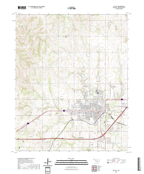
2022 Map of Elk City
USGS Topo · Published 2022About this map
Elk City dominates the landscape of western Oklahoma in this 2020s study, revealing the dense grid of a regional hub alongside its expanding infrastructure. The city's growth is marked by the presence of Elk City Regional Business Airport to the northeast and a complex network of residential streets and industrial corridors. Genealogy interests are well-served by the proximity of numerous burial sites, including Fairlawn Cem, East Fairlawn Cem, and Calvary Cem clustered together, with Evergreen Cem situated to the south and Grandview Cem found further north near Big Kiowa Creek.
Find a feature on this map
74 named features on this map. Tap any name to fly to it.
Don’t see what you’re looking for? This feature index may not catch every label — zoom into the map to look around manually.
Map Details
Editions of this 2022 Elk City Map
This is the sole edition of this map. No revisions or reprints were ever made.
Other maps of this area

1955 · Clinton
USGS Topo · 1:250,000

1957 · Clinton
USGS Topo · 1:250,000

1960 · Cheyenne
USGS Topo · 1:62,500

1960 · Sayre
USGS Topo · 1:62,500

1960 · Hammon
USGS Topo · 1:62,500

1961 · Elk City
USGS Topo · 1:62,500

1984 · Foss Reservoir
USGS Topo · 1:100,000

1985 · Elk City
USGS Topo · 1:100,000

1987 · Big Kiowa Creek
USGS Topo · 1:24,000

1987 · Elk City
USGS Topo · 1:24,000