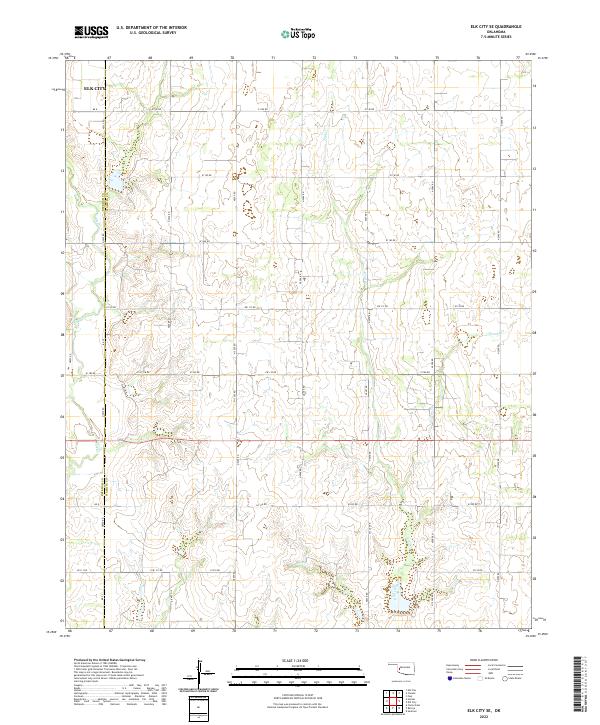
2022 Map of Elk City SE
USGS Topo · Published 2022About this map
Elk City anchors the northwest corner of this agricultural landscape, where the prairie of Western Oklahoma is defined by a rigorous section-line road grid. The terrain is drained by a series of south-flowing waterways, including Elk Cr, Trail Cr, and George Cr, which carve subtle drainage patterns across the red-soil plains. Positioned along the border of Beckham Co and Washita Co, the map reveals a highly structured rural environment where local transport is facilitated by an extensive network of designated roads like E1140 Rd and N2090 Rd. This modern survey by the U.S. Geological Survey illustrates how the original Public Land Survey System continues to dictate the human geography of the region, with ranching and farming operations organized within the strictly maintained townships of t10n r20w and t9n r20w.
Find a feature on this map
41 named features on this map. Tap any name to fly to it.
Don’t see what you’re looking for? This feature index may not catch every label — zoom into the map to look around manually.
Map Details
Editions of this 2022 Elk City SE Map
This is the sole edition of this map. No revisions or reprints were ever made.
Other maps of this area

1955 · Clinton
USGS Topo · 1:250,000

1957 · Clinton
USGS Topo · 1:250,000

1957 · Dill City
USGS Topo · 1:62,500

1961 · Hobart
USGS Topo · 1:62,500

1961 · Retrop
USGS Topo · 1:62,500

1961 · Elk City
USGS Topo · 1:62,500

1976 · Dill City NE
USGS Topo · 1:24,000
1983 · Foss
USGS Topo · 1:24,000

1983 · Dill City
USGS Topo · 1:24,000

1984 · Sentinel
USGS Topo · 1:24,000