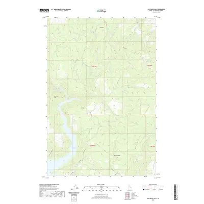
2020 Map of Elk Creek Falls
USGS Topo · Published 2020About this map
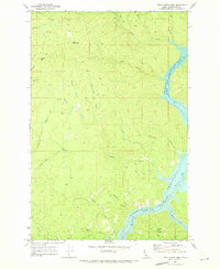
Elk Creek Falls and the cascading waters of Bull Run Creek Falls define the northern drainages of this Clearwater County landscape. The terrain is characterized by prominent high ground, including Tick Ridge, Aldermand Ridge, and Elk Ridge, which separate the various creek systems feeding into the southern reaches of the Dworshak Reservoir. Settlement patterns are sparse, marked primarily by the locations at Twin Springs and Five Corners. The network of forest roads, such as Elk River Rd and Dent Bridge Rd, traces the complex topography between the reservoir and the high meadows. This 2020 record captures the hydrology and road access of the region, where the elevation drops from over 3,000 feet down to the reservoir shoreline, illustrating the relationship between the rugged timberlands and the managed water systems of northern Idaho.
Find a feature on this map
31 named features on this map. Tap any name to fly to it.
Don’t see what you’re looking for? This feature index may not catch every label — zoom into the map to look around manually.
Map Details
Editions of this 2020 Elk Creek Falls Map
This is the sole edition of this map. No revisions or reprints were ever made.
Other maps of this area

1955 · Pullman
USGS Topo · 1:250,000

1958 · Pullman
USGS Topo · 1:250,000

1961 · Ahsahka
USGS Topo · 1:62,500

1961 · Bovill
USGS Topo · 1:62,500

1969 · Elk River
USGS Topo · 1:24,000

1969 · Elk Creek Falls
USGS Topo · 1:24,000
1969 · Grangemont
USGS Topo · 1:24,000
1969 · Dent
USGS Topo · 1:24,000
1969 · Elk Butte
USGS Topo · 1:24,000
1969 · Little Green Mountain
USGS Topo · 1:24,000