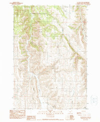
1990 Map of Elk Mountain
USGS Topo · Published 1990About this map
Wallowa National Forest land dominates this high-country survey of northeastern Oregon, defined by a complex network of drainages and prominent peaks. Elk Mountain stands as the central landmark, its slopes carved by seasonal and perennial waterways like Swamp Creek and Crow Creek. The terrain is deeply incised, shown through the narrow passages of Stack Canyon and Baker Canyon. While largely unpopulated, the presence of the Base Line and the detailed mapping of Arkansas Hollow and Gould Gulch reveal the underlying surveying framework used to manage this public timberland. The map provides a clear picture of the hydrological patterns of the Blue Mountains region before late-20th-century shifts in forest management, tracing the paths of Beaver Creek and Baker Creek through the steep, wooded topography.
Find a feature on this map
12 named features on this map. Tap any name to fly to it.
Don’t see what you’re looking for? This feature index may not catch every label — zoom into the map to look around manually.
Map Details
Editions of this 1990 Elk Mountain Map
This is the sole edition of this map. No revisions or reprints were ever made.
Other maps of this area

1955 · Grangeville
USGS Topo · 1:250,000

1957 · Enterprise
USGS Topo · 1:62,500

1957 · Joseph
USGS Topo · 1:62,500

1957 · Sled Springs
USGS Topo · 1:62,500

1957 · Elk Mountain
USGS Topo · 1:62,500

1959 · Grangeville
USGS Topo · 1:250,000

1982 · Wallowa
USGS Topo · 1:100,000

1986 · Enterprise
USGS Topo · 1:100,000
1990 · Hicks Spring
USGS Topo · 1:24,000
1990 · Three Lakes Country
USGS Topo · 1:24,000