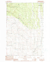
1990 Map of Hicks Spring
USGS Topo · Published 1990About this map
Hicks Spring and the surrounding high country of the Wallowa National Forest define this 1990 survey of northeastern Oregon. The landscape is carved by a complex drainage system, most notably the three branches of Whisky Creek—North Fork Whisky Creek, Middle Fork Whisky Creek, and South Fork Whisky Creek. These waterways, along with Patsnip Creek and Trout Creek, illustrate the hydrologic patterns of the region's uplands. Pockets of level terrain appear at Braham Meadows and Miller Meadow, while the presence of a Gravel Pit and several quarries indicates the local extraction industry. The map also records the location of the Base Line and the boundary between T 1 N and T 1 S, essential markers for land management and cadastral history in Wallowa County.
Find a feature on this map
13 named features on this map. Tap any name to fly to it.
Don’t see what you’re looking for? This feature index may not catch every label — zoom into the map to look around manually.
Map Details
Editions of this 1990 Hicks Spring Map
This is the sole edition of this map. No revisions or reprints were ever made.
Other maps of this area

1955 · Grangeville
USGS Topo · 1:250,000

1957 · Enterprise
USGS Topo · 1:62,500

1957 · Joseph
USGS Topo · 1:62,500

1957 · Sled Springs
USGS Topo · 1:62,500

1957 · Elk Mountain
USGS Topo · 1:62,500

1959 · Grangeville
USGS Topo · 1:250,000

1982 · Wallowa
USGS Topo · 1:100,000

1986 · Enterprise
USGS Topo · 1:100,000

1990 · Lostine
USGS Topo · 1:24,000
1990 · Sherod Meadows
USGS Topo · 1:24,000