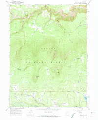
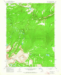
1963 Map of Elk Park
USGS Topo · Published 1974About this map
High-elevation parks and timberlands dominate this portion of the Ashley National Forest along the border of Daggett and Uintah counties. The landscape is defined by the headwaters of several major drainages, including the various forks of South Fork Ashley Creek and Center Fork Ashley Creek, which carve through the high plateaus. Evidence of early land management and frontier transit is visible in the Old Military Reservation Boundary and the Uinta Highline Trail crossing the northern terrain. Named for local figures or descriptive landforms, scattered mountain meadows like Pat Carroll Park, Soldier Park, and Meadow Park provided critical clearings within the dense forest. In the south, the Trout Creek Guard Sta and the Oaks Park Reservoir signify the mid-century infrastructure required for forest oversight and water storage in this mountain environment.
Find a feature on this map
37 named features on this map. Tap any name to fly to it.
Don’t see what you’re looking for? This feature index may not catch every label — zoom into the map to look around manually.
Map Details
Editions of this 1963 Elk Park Map
3 editions found
Other maps of this area

1885 · Ashley
USGS Topo · 1:250,000

1906 · Marsh Peak
USGS Topo · 1:125,000

1908 · Marsh Peak
USGS Topo · 1:125,000

1950 · Dyer Mountain
USGS Topo · 1:24,000

1952 · Flaming Gorge
USGS Topo · 1:24,000

1954 · Vernal
USGS Topo · 1:250,000

1958 · Vernal
USGS Topo · 1:250,000

1960 · Vernal
USGS Topo · 1:250,000
1963 · Manila
USGS Topo · 1:24,000
1963 · Leidy Peak
USGS Topo · 1:24,000