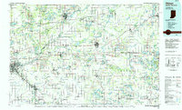
1985 Map of Elkhart
USGS Topo · Published 1985About this map
The St. Joseph River and its major tributaries, including the Elkhart River and Pigeon River, define the hydraulic character of this cross-border region in the mid-1980s. This survey records the dense industrial and transit corridor stretching from Elkhart through Goshen, where the Conrail and Norfolk And Western railroad networks intersect with the Indiana Toll Road. The landscape transitions from these urban manufacturing centers to the agricultural heartlands of Lagrange and Middlebury, marked by smaller settlements like Topeka and Honeyville. Further east, the terrain becomes increasingly defined by glacial lakes and conservation efforts, exemplified by the expansive Pigeon River Fish and Wildlife Area and Pokagon State Park. In Michigan, the strategic positioning of Three Rivers and Sturgis highlights the historical importance of rail and river junctions in sustaining the regional trade between northern Indiana and southern Michigan.
Find a feature on this map
184 named features on this map. Tap any name to fly to it.
Don’t see what you’re looking for? This feature index may not catch every label — zoom into the map to look around manually.
Map Details
Editions of this 1985 Elkhart Map
2 editions found
Other maps of this area

1914 · Three Rivers
USGS Topo · 1:62,500

1916 · Three Rivers
USGS Topo · 1:62,500

1918 · Union City
USGS Topo · 1:62,500

1918 · Leonidas
USGS Topo · 1:62,500

1922 · Schoolcraft
USGS Topo · 1:62,500

1927 · Hartford
USGS Topo · 1:62,500

1931 · Hartford
USGS Topo · 1:62,500

1939 · Hamilton
USGS Topo · 1:24,000

1939 · Angola East
USGS Topo · 1:24,000

1940 · Orland
USGS Topo · 1:24,000