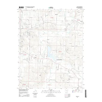
2014 Map of Elkins
USGS Topo · Published 2014About this map
Fayetteville and its eastern surroundings are defined by the convergence of several river branches, creating a landscape of deep valleys and isolated peaks. The White River meets with the Middle Fork White River, W Fork White River, and Mud Cr near the center of the sheet, where Lake Sequoyah dominates the geography between Baldwin and Harris. These waterways provided the fundamental structure for the area's development, evidenced by the string of small settlements like Wyman, Habberton, and Goshen that trace the river bends.
Find a feature on this map
153 named features on this map. Tap any name to fly to it.
Don’t see what you’re looking for? This feature index may not catch every label — zoom into the map to look around manually.
Map Details
Editions of this 2014 Elkins Map
This is the sole edition of this map. No revisions or reprints were ever made.
Other maps of this area

1898 · Winslow
USGS Topo · 1:125,000

1899 · Fayetteville
USGS Topo · 1:125,000

1900 · Eureka Springs
USGS Topo · 1:125,000

1901 · Winslow
USGS Topo · 1:125,000

1901 · Eureka Springs
USGS Topo · 1:125,000

1901 · Fayetteville
USGS Topo · 1:125,000

1904 · Fayetteville
USGS Topo · 1:125,000

1943 · St. Paul
USGS Topo · 1:62,500

1945 · Harrison
USGS Topo · 1:250,000

1946 · St. Paul
USGS Topo · 1:62,500