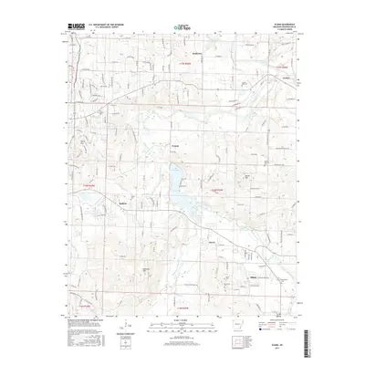
2017 Map of Elkins
USGS Topo · Published 2017About this map
The White River and its various tributaries define the landscape of eastern Washington County in this late 2010s survey. This area is characterized by the convergence of the West Fork White River and the Middle Fork White River near Lake Sequoyah, creating a complex hydrological network that has shaped local settlement patterns for generations. Small communities such as Elkins, Harris, Baldwin, and Goshen are connected by a web of county roads, including Co RD 48 and Co RD 195, which navigate the elevation changes near Round Mountain and Robinson Mtn. For genealogists and local historians, the map is particularly detailed in its marking of burial sites, including the Stokenbury Cem, Oxford Bend Cem, and Boone Cem. These landmarks, alongside smaller water features like Roger Br and Mud Cr, provide a clear view of the rural-to-suburban transition occurring outside of Fayetteville.
Find a feature on this map
63 named features on this map. Tap any name to fly to it.
Don’t see what you’re looking for? This feature index may not catch every label — zoom into the map to look around manually.
Map Details
Editions of this 2017 Elkins Map
This is the sole edition of this map. No revisions or reprints were ever made.
Other maps of this area

1898 · Winslow
USGS Topo · 1:125,000

1899 · Fayetteville
USGS Topo · 1:125,000

1900 · Eureka Springs
USGS Topo · 1:125,000

1901 · Winslow
USGS Topo · 1:125,000

1901 · Eureka Springs
USGS Topo · 1:125,000

1901 · Fayetteville
USGS Topo · 1:125,000

1904 · Fayetteville
USGS Topo · 1:125,000

1943 · St. Paul
USGS Topo · 1:62,500

1945 · Harrison
USGS Topo · 1:250,000

1946 · St. Paul
USGS Topo · 1:62,500