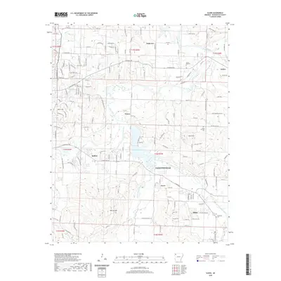
2020 Map of Elkins
USGS Topo · Published 2020About this map
The White River and its multiple forks define the landscape east of Fayetteville, where the river system creates a complex network of valleys and ridges. In the southeast, the city of Elkins sits near the confluence of the Middle Fork White River and the main channel, while the W Fork White River feeds into Lake Sequoyah further north. This drainage pattern historically influenced the placement of early settlements and family cemeteries such as Stokenbury Cem, Boone Cem, and Burkhead Cem, which are tucked away from the river's immediate floodplains.
Find a feature on this map
60 named features on this map. Tap any name to fly to it.
Don’t see what you’re looking for? This feature index may not catch every label — zoom into the map to look around manually.
Map Details
Editions of this 2020 Elkins Map
This is the sole edition of this map. No revisions or reprints were ever made.
Other maps of this area

1898 · Winslow
USGS Topo · 1:125,000

1899 · Fayetteville
USGS Topo · 1:125,000

1900 · Eureka Springs
USGS Topo · 1:125,000

1901 · Winslow
USGS Topo · 1:125,000

1901 · Eureka Springs
USGS Topo · 1:125,000

1901 · Fayetteville
USGS Topo · 1:125,000

1904 · Fayetteville
USGS Topo · 1:125,000

1943 · St. Paul
USGS Topo · 1:62,500

1945 · Harrison
USGS Topo · 1:250,000

1946 · St. Paul
USGS Topo · 1:62,500