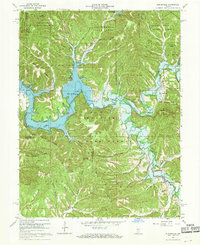
1966 Map of Elkinsville
USGS Topo · Published 1968About this map
Elkinsville and the surrounding wilderness of the Hoosier National Forest are captured here during a transformative era for southern Indiana's landscape. The creation of the Monroe Reservoir dominates the central topography, with the map clearly delineating the controlled inundation areas and the U S Reservation Boundary. This hydraulic project reshaped the local geography, particularly along the Middle Fork Salt Creek and the South Fork Salt Creek.
Find a feature on this map
71 named features on this map. Tap any name to fly to it.
Don’t see what you’re looking for? This feature index may not catch every label — zoom into the map to look around manually.
Map Details
Editions of this 1966 Elkinsville Map
4 editions found
Other maps of this area

1934 · Bedford
USGS Topo · 1:48,000

1937 · Bedford
USGS Topo · 1:62,500

1942 · Franklin
USGS Topo · 1:125,000

1946 · Belmont
USGS Topo · 1:24,000

1947 · Allens Creek
USGS Topo · 1:24,000

1947 · Unionville
USGS Topo · 1:24,000

1947 · Nashville
USGS Topo · 1:24,000

1947 · Elkinsville
USGS Topo · 1:24,000

1949 · Nashville
USGS Topo · 1:24,000

1950 · Belmont
USGS Topo · 1:24,000