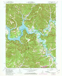
1966 Map of Elkinsville
USGS Topo · Published 1981About this map
Monroe Lake dominates this mid-century landscape at its normal pool elevation of 538 feet, its fingers reaching deep into the drainage of the Salt Creek forks. The settlement of Elkinsville sits at the edge of the water near the Elkinsville Cem, while further south, Maumee serves as another focal point for local families. The terrain is defined by a dense network of timbered ridges, including Gilmore Ridge and Deckard Ridge, much of which is protected within the Yellowwood State Forest and Hoosier National Forest. Family-named landmarks such as John Grubb Ridge and Browning Hill testify to generations of land use. Rural life is anchored by institutions like Crooked Creek Ch and the Hickory Ridge Lookout Tower, providing a detailed view of Brown County before modernization further altered these remote valleys.
Find a feature on this map
64 named features on this map. Tap any name to fly to it.
Don’t see what you’re looking for? This feature index may not catch every label — zoom into the map to look around manually.
Map Details
Editions of this 1966 Elkinsville Map
4 editions found
Other maps of this area

1934 · Bedford
USGS Topo · 1:48,000

1937 · Bedford
USGS Topo · 1:62,500

1942 · Franklin
USGS Topo · 1:125,000

1946 · Belmont
USGS Topo · 1:24,000

1947 · Allens Creek
USGS Topo · 1:24,000

1947 · Unionville
USGS Topo · 1:24,000

1947 · Nashville
USGS Topo · 1:24,000

1947 · Elkinsville
USGS Topo · 1:24,000

1949 · Nashville
USGS Topo · 1:24,000

1950 · Belmont
USGS Topo · 1:24,000