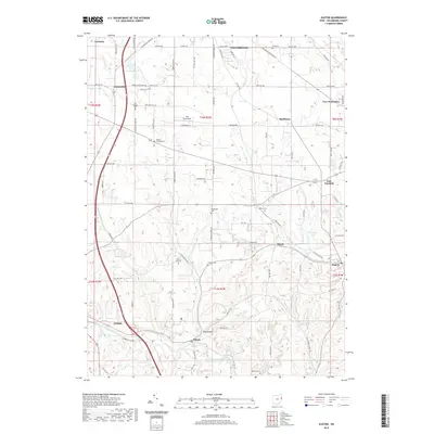
2019 Map of Elkton
USGS Topo · Published 2019About this map
Elkton and the surrounding townships in Columbiana County are defined by a deeply dissected landscape where small settlements are linked by a dense network of township and county roads. The Middle Fork Little Beaver Creek winds through the southern portion of the area near Lisbon, passing the distinctive Pine Hollow terrain. This region preserves an extensive record of early community life through its numerous burial grounds, including the Cool Springs Cem and the Church Hill Cem located near the headwaters of Elk Run. To the north, the terrain levels out slightly as it approaches Columbiana, where the York Aerodrome sits among active agricultural fields. Small hamlets like Signal, Rogers, and East Fairfield mark the junctions of regional routes, while secluded water bodies such as Shiveleys Lake and Lake Copeland are tucked into the upland folds of the plateau.
Find a feature on this map
93 named features on this map. Tap any name to fly to it.
Don’t see what you’re looking for? This feature index may not catch every label — zoom into the map to look around manually.
Map Details
Editions of this 2019 Elkton Map
This is the sole edition of this map. No revisions or reprints were ever made.
Other maps of this area

1904 · Wellsville
USGS Topo · 1:62,500

1905 · Salineville
USGS Topo · 1:62,500

1907 · Columbiana
USGS Topo · 1:62,500

1909 · Lisbon
USGS Topo · 1:62,500

1909 · Columbiana
USGS Topo · 1:62,500

1937 · Wellsville
USGS Topo · 1:62,500

1944 · Wellsville
USGS Topo · 1:62,500

1951 · Canton
USGS Topo · 1:250,000

1951 · Columbiana
USGS Topo · 1:24,000
1951 · New Middletown
USGS Topo · 1:24,000