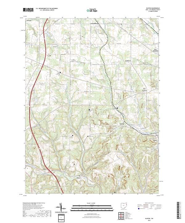
2023 Map of Elkton
USGS Topo · Published 2023About this map
Middle Fork Little Beaver Creek winds through the southern portion of this landscape, anchoring the village of Lisbon and the nearby settlement of Elkton. The terrain is defined by a dense network of township and county roads that connect historical family and community landmarks, including a high concentration of burial sites such as Bethel - Fairfield Cem and Zeppernick Cem. Small water bodies like Peterson Pond and Als Lake dot the countryside, while the York Aerodrome serves as a notable modern landmark amidst the agricultural fields. The drainage patterns of Elk Run and Little Bull Creek carve out the local topography, linking several small communities like Signal and Rogers. This map records the rural character of Columbiana County, showing the persistent footprint of long-established settlements and the cemeteries that preserve the names of early resident families.
Find a feature on this map
91 named features on this map. Tap any name to fly to it.
Don’t see what you’re looking for? This feature index may not catch every label — zoom into the map to look around manually.
Map Details
Editions of this 2023 Elkton Map
This is the sole edition of this map. No revisions or reprints were ever made.
Other maps of this area

1904 · Wellsville
USGS Topo · 1:62,500

1905 · Salineville
USGS Topo · 1:62,500

1907 · Columbiana
USGS Topo · 1:62,500

1909 · Lisbon
USGS Topo · 1:62,500

1909 · Columbiana
USGS Topo · 1:62,500

1937 · Wellsville
USGS Topo · 1:62,500

1944 · Wellsville
USGS Topo · 1:62,500

1951 · Canton
USGS Topo · 1:250,000

1951 · Columbiana
USGS Topo · 1:24,000
1951 · New Middletown
USGS Topo · 1:24,000