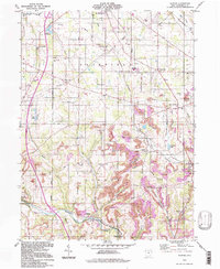
1994 Map of Elkton
USGS Topo · Published 1997About this map
Elkton and the surrounding townships of Elkrun and Fairfield define this landscape, where the rugged topography of the Pine Hollow region meets the industrial legacy of eastern Ohio. Extensively marked by Strip Mine operations and Strip Mines, the terrain reveals a history of resource extraction that shaped local development alongside the Youngstown and Southern rail line. Genealogists will find a high density of rural burial grounds, including the Bethel-Fairfield Cem, Cool Springs Cem, and the family-named Kembles Cem. The southern portion of the map transitions into the protected woodlands of Beaver Creek State Park, where the Middle Fork Little Beaver Creek winds through the valley. This 1994 update of earlier surveys maintains the positions of local landmarks like the Church Hill Ch and several one-room school sites, such as the Township Sch, providing a clear view of the area's rural social structure before modern expansion.
Find a feature on this map
52 named features on this map. Tap any name to fly to it.
Don’t see what you’re looking for? This feature index may not catch every label — zoom into the map to look around manually.
Map Details
Editions of this 1994 Elkton Map
This is the sole edition of this map. No revisions or reprints were ever made.
Other maps of this area

1904 · Wellsville
USGS Topo · 1:62,500

1905 · Salineville
USGS Topo · 1:62,500

1907 · Columbiana
USGS Topo · 1:62,500

1909 · Lisbon
USGS Topo · 1:62,500

1909 · Columbiana
USGS Topo · 1:62,500

1937 · Wellsville
USGS Topo · 1:62,500

1944 · Wellsville
USGS Topo · 1:62,500

1951 · Canton
USGS Topo · 1:250,000

1951 · Columbiana
USGS Topo · 1:24,000
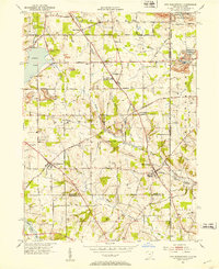
1951 · New Middletown
USGS Topo · 1:24,000