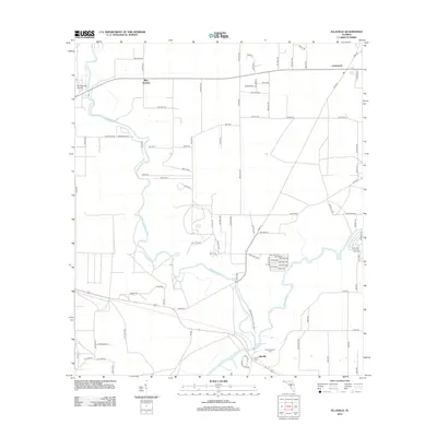
2012 Map of Ellaville
USGS Topo · Published 2012About this map
The Withlacoochee River meets the Suwannee River in this part of Madison County, a convergence point that defines the local landscape and its history. This 2012 survey shows the settlement of Ellaville near the river junction, an area preserved as part of the Suwannee River State Park. The landscape is dotted with natural artesian features, including Blue Springs, Morgans Spring, Adams Spring, and Suwanacoochee Spring, reflecting the region's unique hydrology. For those researching local ancestry, the map identifies the Old Columbus Cem and Dean Cem near the riverbanks. Aviation history is noted by the Blue Springs Airport in the northwest, while the small community of Crossroads marks the intersection of rural routes in the northeast corner of the quadrangle.
Find a feature on this map
98 named features on this map. Tap any name to fly to it.
Don’t see what you’re looking for? This feature index may not catch every label — zoom into the map to look around manually.
Map Details
Editions of this 2012 Ellaville Map
This is the sole edition of this map. No revisions or reprints were ever made.
Other maps of this area

1954 · Valdosta
USGS Topo · 1:250,000

1956 · Jennings
USGS Topo · 1:24,000

1956 · Octahatchee
USGS Topo · 1:24,000

1958 · Valdosta
USGS Topo · 1:250,000

1958 · Fort Union
USGS Topo · 1:24,000

1958 · Madison SE
USGS Topo · 1:24,000

1958 · Lee
USGS Topo · 1:24,000

1959 · Valdosta
USGS Topo · 1:250,000

1959 · Ellaville
USGS Topo · 1:24,000

1959 · Live Oak West
USGS Topo · 1:24,000