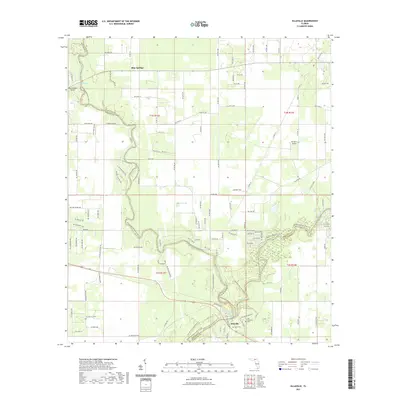
2021 Map of Ellaville
USGS Topo · Published 2021About this map
The confluence of the Withlacoochee River and the Suwannee River serves as the central focal point of this North Florida landscape, where the borders of Madison, Hamilton, and Suwannee Counties meet. At this river junction lies Ellaville, a site defined by its proximity to these major waterways and the surrounding protected lands of the Twin Rivers State Forest Trl. Further north, Blue Springs marks another significant hydrological feature, accompanied by its namesake Blue Springs Airport. For those researching the area's early residents, the presence of the Old Columbus Cem and Dean Cem near the riverbanks provides valuable genealogical connections. The terrain is dotted with numerous artesian features, including Adams Spring and Morgans Spring, illustrating the characteristic karst topography of the Suwannee Valley. The map also documents local aviation history through the private DJ Farm Airport located in the eastern sections of the quadrangle.
Find a feature on this map
124 named features on this map. Tap any name to fly to it.
Don’t see what you’re looking for? This feature index may not catch every label — zoom into the map to look around manually.
Map Details
Editions of this 2021 Ellaville Map
This is the sole edition of this map. No revisions or reprints were ever made.
Other maps of this area

1954 · Valdosta
USGS Topo · 1:250,000

1956 · Jennings
USGS Topo · 1:24,000

1956 · Octahatchee
USGS Topo · 1:24,000

1958 · Valdosta
USGS Topo · 1:250,000

1958 · Fort Union
USGS Topo · 1:24,000

1958 · Madison SE
USGS Topo · 1:24,000

1958 · Lee
USGS Topo · 1:24,000

1959 · Valdosta
USGS Topo · 1:250,000

1959 · Ellaville
USGS Topo · 1:24,000

1959 · Live Oak West
USGS Topo · 1:24,000