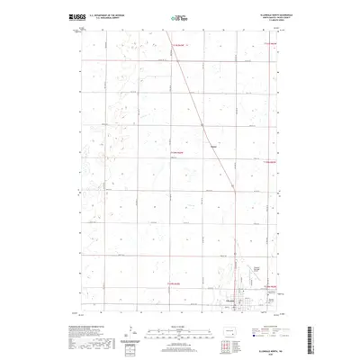
2020 Map of Ellendale North
USGS Topo · Published 2020About this map
The prairie landscape of Dickey County is defined by the northern outskirts of Ellendale, where the transition from town grid to vast agricultural sections is clearly marked. This 2020 survey documents the local infrastructure supporting the community, including the Ellendale Municipal Airport and the precise layout of the town’s northern streets such as Main St and N 1st St. Genealogists will find particular value in the documentation of local burial sites, specifically Saint Helena's Catholic Cem and the Ellendale City Cem, both situated on the eastern edge of the settlement. North of the city, the land is etched by the winding course of Sewer Br and dotted with numerous small wetlands. The small railroad-aligned settlement of Duane remains a focal point along the diagonal transport corridor, surrounded by the strict geometry of the Public Land Survey System township and range lines.
Find a feature on this map
41 named features on this map. Tap any name to fly to it.
Don’t see what you’re looking for? This feature index may not catch every label — zoom into the map to look around manually.
Map Details
Editions of this 2020 Ellendale North Map
This is the sole edition of this map. No revisions or reprints were ever made.
Other maps of this area

1894 · Monango
USGS Topo · 1:62,500

1894 · Ellendale
USGS Topo · 1:62,500

1894 · Savo
USGS Topo · 1:62,500

1894 · Fullerton
USGS Topo · 1:62,500

1895 · Lamoure
USGS Topo · 1:125,000

1896 · Columbia
USGS Topo · 1:125,000

1896 · Edgeley
USGS Topo · 1:125,000

1899 · Ellendale
USGS Topo · 1:125,000

1918 · La Moure
USGS Topo · 1:125,000

1925 · Edgeley
USGS Topo · 1:125,000