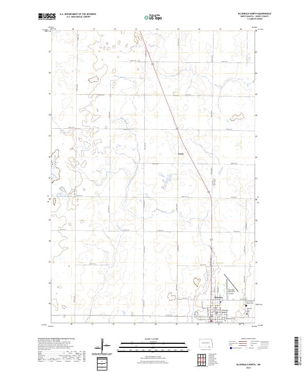
2024 Map of Ellendale North
USGS Topo · Published 2024About this map
Ellendale serves as the focal point of this Dickey County survey, where the town's grid meets the surrounding agricultural landscape of southeastern North Dakota. The presence of the Dickey County Court House and Trinity Bible College underscores the community's role as a regional administrative and educational center. To the north, the small settlement of Duane is situated along a primary north-south corridor, while the meandering course of Sewer Branch provides a rare hydrographic feature in a terrain otherwise defined by numerous small depressions and sloughs. Genealogists and local historians can locate several important sites on the periphery of the town center, including Saint Helena's Catholic Cem and the Ellendale City Cem, as well as the Ellendale Municipal Airport to the east. The map detail highlights a well-developed network of rural roads like 90th St SE and Main St, tracing the organized township and range sections typical of the Great Plains.
Find a feature on this map
31 named features on this map. Tap any name to fly to it.
Don’t see what you’re looking for? This feature index may not catch every label — zoom into the map to look around manually.
Map Details
Editions of this 2024 Ellendale North Map
This is the sole edition of this map. No revisions or reprints were ever made.
Other maps of this area

1894 · Monango
USGS Topo · 1:62,500

1894 · Ellendale
USGS Topo · 1:62,500

1894 · Savo
USGS Topo · 1:62,500

1894 · Fullerton
USGS Topo · 1:62,500

1895 · Lamoure
USGS Topo · 1:125,000

1896 · Columbia
USGS Topo · 1:125,000

1896 · Edgeley
USGS Topo · 1:125,000

1899 · Ellendale
USGS Topo · 1:125,000

1918 · La Moure
USGS Topo · 1:125,000

1925 · Edgeley
USGS Topo · 1:125,000