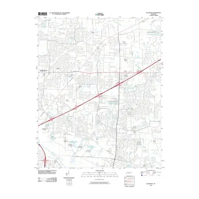
2010 Map of Ellendale
USGS Topo · Published 2010About this map
The Wolf River floodplain and its northern drainage basins define this portion of Shelby County during a period of significant suburban expansion. The sprawling Shelby County Penal Farm occupies much of the southern landscape, characterized by a series of engineered water bodies including Penal Farm Lake Number One and Penal Farm Lake Number Four. This institutional land use stands in contrast to the dense residential and commercial developments spreading from Bartlett and the Cordova Post Office area. A notable concentration of memorial sites, such as Memory Hill Gardens and Toll Gate Cemetery, serves the growing population centers. The map also captures the commercial significance of the Wolfchase Galleria and the presence of the Ranger Airport, illustrating the transition from rural agricultural land to a complex urban-suburban corridor.
Find a feature on this map
69 named features on this map. Tap any name to fly to it.
Don’t see what you’re looking for? This feature index may not catch every label — zoom into the map to look around manually.
Map Details
Editions of this 2010 Ellendale Map
This is the sole edition of this map. No revisions or reprints were ever made.
Other maps of this area

1942 · Millington
USGS Topo · 1:62,500

1943 · Collierville
USGS Topo · 1:62,500

1953 · Collierville
USGS Topo · 1:50,000

1954 · Mason
USGS Topo · 1:62,500

1956 · Blytheville
USGS Topo · 1:250,000

1959 · Blytheville
USGS Topo · 1:250,000

1960 · Bartlett
USGS Topo · 1:62,500

1960 · Millington
USGS Topo · 1:62,500

1961 · Bartlett
USGS Topo · 1:62,500
1965 · Collierville
USGS Topo · 1:24,000