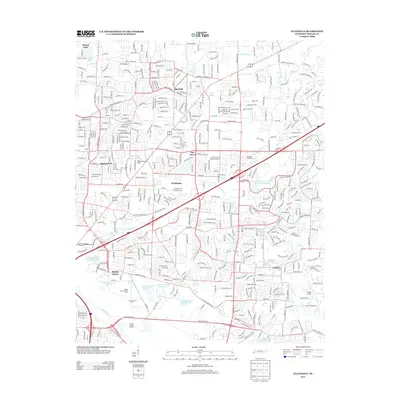
2013 Map of Ellendale
USGS Topo · Published 2013About this map
Shelby Farms and the extensive grounds of the Shelby County Penal Farm dominate the southwestern portion of this landscape, where a series of numbered reservoirs, from Penal Farm Lake Number One to Number Four, sit just north of the Wolf River. The map captures a period of intense suburban transition within eastern Memphis, illustrating the expansion of residential corridors along Memphis Arlington Rd and Germantown Rd.
Find a feature on this map
38 named features on this map. Tap any name to fly to it.
Don’t see what you’re looking for? This feature index may not catch every label — zoom into the map to look around manually.
Map Details
Editions of this 2013 Ellendale Map
This is the sole edition of this map. No revisions or reprints were ever made.
Other maps of this area

1942 · Millington
USGS Topo · 1:62,500

1943 · Collierville
USGS Topo · 1:62,500

1953 · Collierville
USGS Topo · 1:50,000

1954 · Mason
USGS Topo · 1:62,500

1956 · Blytheville
USGS Topo · 1:250,000

1959 · Blytheville
USGS Topo · 1:250,000

1960 · Bartlett
USGS Topo · 1:62,500

1960 · Millington
USGS Topo · 1:62,500

1961 · Bartlett
USGS Topo · 1:62,500
1965 · Collierville
USGS Topo · 1:24,000