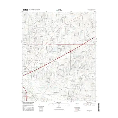
2016 Map of Ellendale
USGS Topo · Published 2016About this map
Memphis and its northeastern expansion define this mid-2010s landscape, where suburban residential development meets the natural corridor of the Wolf River. The community of Ellendale sits in the northern section, while Cordova occupies the southeast, reflecting the rapid growth of Shelby County in this era. A series of water bodies, including Penal Farm Lake Number One through Number Four, suggest a history of agricultural or utility-based land use now integrated into the urban fabric. Large memorial sites and recreational areas, such as Memory Hill Gardens and the Colonial Country Club, occupy significant acreage between the major transit arteries of Sam Cooper Blvd and Stage Rd. Genealogists will find several burial grounds noted, including New Hope Cem and the small Toll Gate Cem, providing vital points for local family history research.
Find a feature on this map
47 named features on this map. Tap any name to fly to it.
Don’t see what you’re looking for? This feature index may not catch every label — zoom into the map to look around manually.
Map Details
Editions of this 2016 Ellendale Map
This is the sole edition of this map. No revisions or reprints were ever made.
Other maps of this area

1942 · Millington
USGS Topo · 1:62,500

1943 · Collierville
USGS Topo · 1:62,500

1953 · Collierville
USGS Topo · 1:50,000

1954 · Mason
USGS Topo · 1:62,500

1956 · Blytheville
USGS Topo · 1:250,000

1959 · Blytheville
USGS Topo · 1:250,000

1960 · Bartlett
USGS Topo · 1:62,500

1960 · Millington
USGS Topo · 1:62,500

1961 · Bartlett
USGS Topo · 1:62,500
1965 · Collierville
USGS Topo · 1:24,000