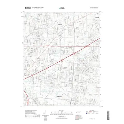
2019 Map of Ellendale
USGS Topo · Published 2019About this map
The suburban landscape of Shelby County is shown in detail during the late 2010s, centered on the growing communities of Bartlett and Cordova. The survey captures a modern road network including Stage Rd and Ikea Way, while still preserving the names of several smaller historical locales like Ellendale. The southern portion of the map is defined by the Wolf River and a series of distinct water bodies collectively identified as Penal Farm Lake Number One through Penal Farm Lake Number Four, reflecting the specialized land use of the regional correctional system.
Find a feature on this map
54 named features on this map. Tap any name to fly to it.
Don’t see what you’re looking for? This feature index may not catch every label — zoom into the map to look around manually.
Map Details
Editions of this 2019 Ellendale Map
This is the sole edition of this map. No revisions or reprints were ever made.
Other maps of this area

1942 · Millington
USGS Topo · 1:62,500

1943 · Collierville
USGS Topo · 1:62,500

1953 · Collierville
USGS Topo · 1:50,000

1954 · Mason
USGS Topo · 1:62,500

1956 · Blytheville
USGS Topo · 1:250,000

1959 · Blytheville
USGS Topo · 1:250,000

1960 · Bartlett
USGS Topo · 1:62,500

1960 · Millington
USGS Topo · 1:62,500

1961 · Bartlett
USGS Topo · 1:62,500
1965 · Collierville
USGS Topo · 1:24,000