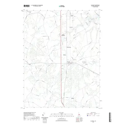
2019 Map of Ellendale
USGS Topo · Published 2019About this map
Ellendale stands as a central hub on the Delmarva Peninsula in this modern survey of central Sussex County. The landscape is defined by the expansive Ellendale Swamp, which dominates the southern half of the quadrangle and influences the local drainage patterns. Water flows through a network of small creeks and ditches, including Gravelly Br, Maple Br, and the engineered Gravelly Ditch. These waterways reflect the agricultural and natural heritage of the region, where low-lying terrain necessitated complex water management.
Find a feature on this map
105 named features on this map. Tap any name to fly to it.
Don’t see what you’re looking for? This feature index may not catch every label — zoom into the map to look around manually.
Map Details
Editions of this 2019 Ellendale Map
This is the sole edition of this map. No revisions or reprints were ever made.
Other maps of this area

1915 · Seaford
USGS Topo · 1:62,500

1917 · Millsboro
USGS Topo · 1:62,500

1918 · Cedar Creek
USGS Topo · 1:62,500

1918 · Harrington
USGS Topo · 1:62,500

1919 · Cedar Creek
USGS Topo · 1:62,500

1938 · Cedar Creek
USGS Topo · 1:62,500

1938 · Millsboro
USGS Topo · 1:62,500
1944 · Milton
USGS Topo · 1:24,000

1944 · Cedar Creek
USGS Topo · 1:62,500

1944 · Millsboro
USGS Topo · 1:62,500