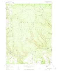
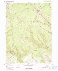
1959 Map of Elliott Park
USGS Topo · Published 1960About this map
Moshannon State Forest and S B Elliott State Park dominate the central high ground of this 1959 survey, where the ridge lines of Hobo Hill and Chestnut Ridge define the local topography. This is a landscape of extraction and conservation, with numerous Strip Mines appearing in the southern sections near the settlement of Greenville and Pleasant Grove Ch. The map captures a critical water management network for Clearfield County, documenting the Du Bois Reservoir, Clearfield Reservoir, and the emerging Curwensville Reservoir at the confluence of several runs.
Find a feature on this map
56 named features on this map. Tap any name to fly to it.
Don’t see what you’re looking for? This feature index may not catch every label — zoom into the map to look around manually.
Map Details
Editions of this 1959 Elliott Park Map
5 editions found
Other maps of this area

1903 · Curwensville
USGS Topo · 1:62,500

1903 · Houtzdale
USGS Topo · 1:62,500

1905 · Houtzdale
USGS Topo · 1:62,500

1929 · Clearfield
USGS Topo · 1:48,000

1929 · Penfield
USGS Topo · 1:62,500

1932 · Clearfield
USGS Topo · 1:62,500

1932 · Penfield
USGS Topo · 1:62,500

1939 · Curwensville
USGS Topo · 1:62,500

1942 · Curwensville
USGS Topo · 1:62,500

1943 · Punxsutawney
USGS Topo · 1:125,000