
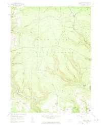
1959 Map of Elliott Park
USGS Topo · Published 1991About this map
S B Elliott State Park and the sprawling Moshannon State Forest dominate this high-plateau landscape of Clearfield County. The area is defined by a dense network of watercourses carving through the terrain, including Anderson Creek, Moose Creek, and Stony Run. Resource extraction and forest management are central to the region's character, evidenced by numerous Gas Well and Strip Mine operations, alongside the State Tree Nursery and several fire and navigation landmarks like the Lookout Tower Elliott and an Airway Beacon.
Find a feature on this map
48 named features on this map. Tap any name to fly to it.
Don’t see what you’re looking for? This feature index may not catch every label — zoom into the map to look around manually.
Map Details
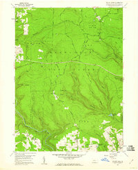
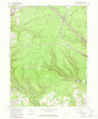
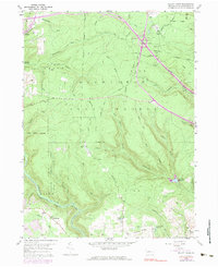
Editions of this 1959 Elliott Park Map
5 editions found
Historical Maps of Pine Township Through Time
30 maps found

1929 Karthaus
Clearfield County, PA

1929 Penfield
Clearfield County, PA

1932 Karthaus
Clearfield County, PA

1932 Penfield
Clearfield County, PA

1944 Glen Richey
Clearfield County, PA

1946 Glen Richey
Clearfield County, PA

1959 Devils Elbow
Clearfield County, PA
1959 Elliott Park
Clearfield County, PA

1959 Frenchville
Clearfield County, PA

1959 Huntley
Clearfield County, PA

1959 Lecontes Mills
Clearfield County, PA

1959 Luthersburg
Clearfield County, PA

1959 Penfield
Clearfield County, PA

1959 Sabula
Clearfield County, PA

1959 The Knobs
Clearfield County, PA

1968 Mc Gees Mills
Clearfield County, PA

1993 Glen Richey
Clearfield County, PA

1993 Penfield
Clearfield County, PA

2000 Lecontes Mills
Clearfield County, PA

2023 Devils Elbow
Clearfield County, PA

2023 Elliott Park
Clearfield County, PA

2023 Frenchville
Clearfield County, PA

2023 Glen Richey
Clearfield County, PA

2023 Huntley
Clearfield County, PA

2023 Lecontes Mills
Clearfield County, PA

2023 Luthersburg
Clearfield County, PA

2023 McGees Mills
Clearfield County, PA

2023 Penfield
Clearfield County, PA

2023 Sabula
Clearfield County, PA

2023 The Knobs
Clearfield County, PA