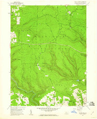
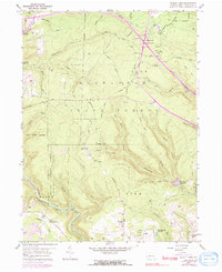
1959 Map of Elliott Park
USGS Topo · Published 1960About this map
Moshannon State Forest dominates this 1959 terrain, where the high plateaus of Clearfield County are deeply incised by the drainage basins of Anderson Creek and Montgomery Run. The landscape is a study in resource management and extraction during the mid-century, featuring the State Tree Nursery and S B Elliott State Park alongside numerous active strip mines. The southern portion of the map reveals the small settlement of Greenville and the Pleasant Grove Ch, providing a glimpse into the rural community life of Bloom and Pike townships.
Find a feature on this map
57 named features on this map. Tap any name to fly to it.
Don’t see what you’re looking for? This feature index may not catch every label — zoom into the map to look around manually.
Map Details
Editions of this 1959 Elliott Park Map
5 editions found
Other maps of this area

1903 · Curwensville
USGS Topo · 1:62,500

1903 · Houtzdale
USGS Topo · 1:62,500

1905 · Houtzdale
USGS Topo · 1:62,500

1929 · Clearfield
USGS Topo · 1:48,000

1929 · Penfield
USGS Topo · 1:62,500

1932 · Clearfield
USGS Topo · 1:62,500

1932 · Penfield
USGS Topo · 1:62,500

1939 · Curwensville
USGS Topo · 1:62,500

1942 · Curwensville
USGS Topo · 1:62,500

1943 · Punxsutawney
USGS Topo · 1:125,000