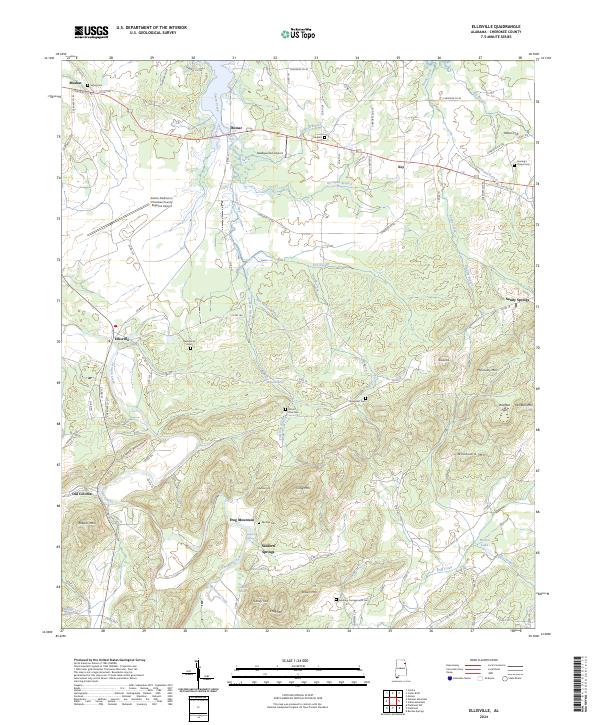
2024 Map of Ellisville
USGS Topo · Published 2024About this map
Frog Mountain and a series of prominent ridges dominate this landscape in southern Cherokee County, where the terrain transitions into the high peaks of Wolfden Mtn and Woodward Mtn. The settlement pattern is defined by rural crossroads like Ellisville and Moshat, with a clear historical footprint preserved at Old Coloma. Local heritage is deeply rooted in the numerous family and community burial sites scattered across the valleys, including Sheepskin Cem, Laney Cem, and the Lebanon Campground Cem.
Find a feature on this map
101 named features on this map. Tap any name to fly to it.
Don’t see what you’re looking for? This feature index may not catch every label — zoom into the map to look around manually.
Map Details
Editions of this 2024 Ellisville Map
This is the sole edition of this map. No revisions or reprints were ever made.
Other maps of this area

1886 · Rome
USGS Topo · 1:125,000

1889 · Tallapoosa
USGS Topo · 1:125,000

1892 · Tallapoosa
USGS Topo · 1:125,000

1893 · Fort Payne
USGS Topo · 1:125,000

1897 · Tallapoosa
USGS Topo · 1:125,000

1898 · Rome
USGS Topo · 1:125,000

1898 · Fort Payne
USGS Topo · 1:125,000

1899 · Rome
USGS Topo · 1:125,000

1900 · Fort Payne
USGS Topo · 1:125,000

1900 · Anniston
USGS Topo · 1:125,000