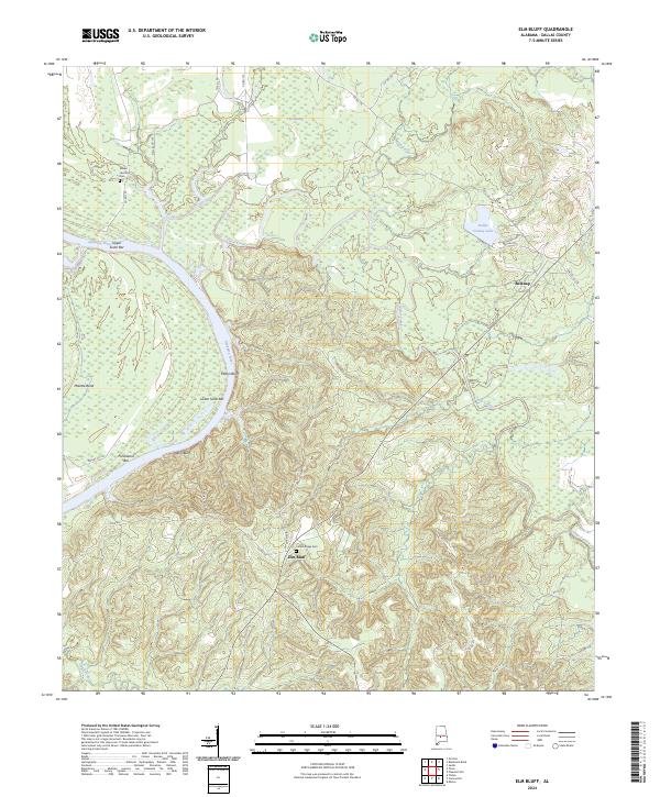
2024 Map of Elm Bluff
USGS Topo · Published 2024About this map
Alabama River navigation and the complex drainage of the Black Belt region define this Dallas County landscape. The river creates dramatic geography at Molette Bend, where shifting currents have deposited notable features like Upper Sister Bar and Lower Sister Bar near the high vantage point of Milton Bluff. Inland, the settlement of Elm Bluff serves as a local anchor near Center Ridge Cem, while the small community of Belknap sits further north. The topography is heavily influenced by water, from the expansive Big Swamp Creek and Titi Swamp in the northern reaches to the recreational waters of Dallas County Lake. For those tracing local heritage, family landmarks like Mount Leveton and its associated Mount Leveton Cem provide specific points of interest within the traditional township and range grid system.
Find a feature on this map
44 named features on this map. Tap any name to fly to it.
Don’t see what you’re looking for? This feature index may not catch every label — zoom into the map to look around manually.
Map Details
Editions of this 2024 Elm Bluff Map
This is the sole edition of this map. No revisions or reprints were ever made.
Other maps of this area

1953 · Montgomery
USGS Topo · 1:250,000

1956 · Montgomery
USGS Topo · 1:250,000

1957 · Montgomery
USGS Topo · 1:250,000

1957 · Carlowville
USGS Topo · 1:62,500

1957 · Benton
USGS Topo · 1:62,500

1957 · Braggs
USGS Topo · 1:62,500

1958 · Selma
USGS Topo · 1:62,500

1975 · Selma SE
USGS Topo · 1:24,000

1975 · Carlowville NE
USGS Topo · 1:24,000
1975 · Benton SW
USGS Topo · 1:24,000