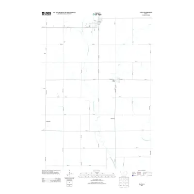
2013 Map of Elma
USGS Topo · Published 2013About this map
Elma and Alta Vista anchor this 2013 survey of the northern Iowa prairie, where the drainage systems of the Little Wapsipinicon River and the E Fork Wapsipinicon River define the local topography. The landscape is organized by a precise grid of county roads, including 190th ST and Cheyenne Ave, which link small rural hubs like Deerfield, Cecilia, and Pleasant Grove. The hydrological character of the region is further detailed by the courses of Mead Cr and Elk Cr as they move through Howard County farmland. This modern U.S. Geological Survey data reflects a century of agricultural continuity, showing the persistent placement of farmsteads and rural crossroads that have remained central to the community since the late 19th-century settlement era.
Find a feature on this map
46 named features on this map. Tap any name to fly to it.
Don’t see what you’re looking for? This feature index may not catch every label — zoom into the map to look around manually.
Map Details
Editions of this 2013 Elma Map
This is the sole edition of this map. No revisions or reprints were ever made.
Other maps of this area

1954 · Mason City
USGS Topo · 1:250,000

1957 · Mason City
USGS Topo · 1:250,000

1958 · Mason City
USGS Topo · 1:250,000

1971 · Bassett
USGS Topo · 1:24,000

1971 · Colwell
USGS Topo · 1:24,000

1972 · Riceville
USGS Topo · 1:24,000
1972 · Ionia
USGS Topo · 1:24,000

1972 · Elma
USGS Topo · 1:24,000

1972 · Jerico
USGS Topo · 1:24,000
1972 · New Hampton
USGS Topo · 1:24,000