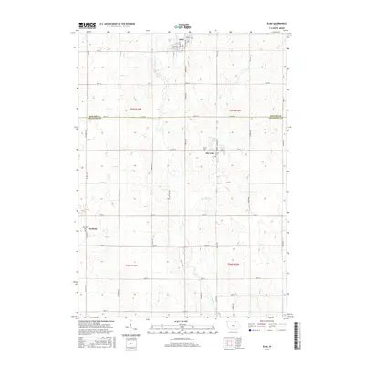
2015 Map of Elma
USGS Topo · Published 2015About this map
Elma and Alta Vista anchor this agricultural landscape in the mid-2010s, situated along the county line between Howard and Chickasaw counties. The area is defined by a dense grid of rural roads like Co Line Rd and Dale Ave, reflecting the enduring township and range surveying system that shaped Iowa's farmland. Waterways including Mead Cr and the Little Wapsipinicon River meander through the terrain, providing natural drainage for the surrounding fields.
Find a feature on this map
52 named features on this map. Tap any name to fly to it.
Don’t see what you’re looking for? This feature index may not catch every label — zoom into the map to look around manually.
Map Details
Editions of this 2015 Elma Map
This is the sole edition of this map. No revisions or reprints were ever made.
Other maps of this area

1954 · Mason City
USGS Topo · 1:250,000

1957 · Mason City
USGS Topo · 1:250,000

1958 · Mason City
USGS Topo · 1:250,000

1971 · Bassett
USGS Topo · 1:24,000

1971 · Colwell
USGS Topo · 1:24,000

1972 · Riceville
USGS Topo · 1:24,000
1972 · Ionia
USGS Topo · 1:24,000

1972 · Elma
USGS Topo · 1:24,000

1972 · Jerico
USGS Topo · 1:24,000
1972 · New Hampton
USGS Topo · 1:24,000