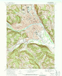
1969 Map of Elmira
USGS Topo · Published 1988About this map
Elmira and its immediate surroundings are captured here at the close of the 1960s, showing a city structured by industrial rail corridors and the curve of the Chemung River. The northern landscape is dominated by the sprawling grounds of the Elmira Reformatory and the adjacent Woodlawn Cemetery, which includes the Woodlawn National Cem. Educational and civic foundations are densely mapped, from the central Elmira College and historic Courthouse to numerous parochial institutions like St Patricks Sch.
Find a feature on this map
81 named features on this map. Tap any name to fly to it.
Don’t see what you’re looking for? This feature index may not catch every label — zoom into the map to look around manually.
Map Details
Editions of this 1969 Elmira Map
Other maps of this area

1895 · Elmira
USGS Topo · 1:62,500

1902 · Waverly
USGS Topo · 1:62,500

1905 · Watkins Glen
USGS Topo · 1:125,000

1931 · Troy
USGS Topo · 1:48,000

1938 · Troy
USGS Topo · 1:62,500

1939 · Sayre
USGS Topo · 1:62,500

1942 · Sayre
USGS Topo · 1:62,500

1948 · Sayre
USGS Topo · 1:62,500

1950 · Elmira
USGS Topo · 1:250,000
1953 · Horseheads
USGS Topo · 1:24,000