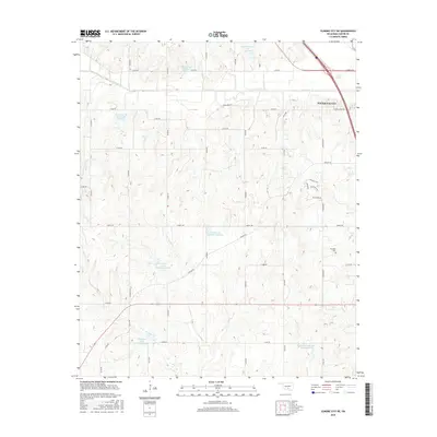
2016 Map of Elmore City NE
USGS Topo · Published 2016About this map
Pauls Valley sits at the northeastern edge of this Garvin County landscape, where the terrain is defined by a sophisticated system of water management. The drainage basins of Rush Creek and Sandy Creek are dotted with numerous numbered reservoirs, including Rush Creek Site 39c Reservoir and several sites along Wildhorse Creek. These impoundments reflect a mid-to-late 20th-century effort to control flooding and provide reliable water sources for local agriculture and petroleum operations. The presence of Shamley Gss Number 1 Reservoir and Temple Gss Number 1 Reservoir further indicates the integration of energy infrastructure into the rural topography. In the eastern hills, the Klondike Cem serves as a quiet landmark of the area's pioneer heritage, surrounded by a network of sectional roads such as Liberty Road and Airline Road.
Find a feature on this map
29 named features on this map. Tap any name to fly to it.
Don’t see what you’re looking for? This feature index may not catch every label — zoom into the map to look around manually.
Map Details
Editions of this 2016 Elmore City NE Map
This is the sole edition of this map. No revisions or reprints were ever made.
Other maps of this area

1898 · Pauls Valley
USGS Topo · 1:125,000

1902 · Pauls Valley
USGS Topo · 1:125,000

1957 · Ardmore
USGS Topo · 1:250,000

1963 · Ardmore
USGS Topo · 1:250,000

1965 · Byars SW
USGS Topo · 1:24,000

1965 · Pauls Valley
USGS Topo · 1:24,000

1965 · Maysville
USGS Topo · 1:24,000

1965 · Joy
USGS Topo · 1:24,000

1965 · Paoli
USGS Topo · 1:24,000

1969 · Hennepin
USGS Topo · 1:24,000