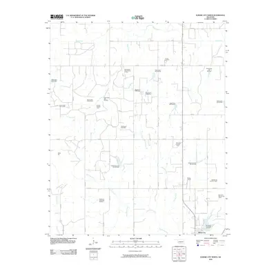
2009 Map of Elmore City North
USGS Topo · Published 2009About this map
Elmore City and its surrounding rural landscapes are defined by an intricate network of watershed management and agricultural infrastructure. Numerous soil conservation structures, such as Wildhorse Creek Site 100 Dam and Rush Creek Site 34 Dam, dot the terrain along the many winding waterways like Panther Creek and East Rock Creek. This density of dammed sites suggests a landscape heavily modified for water control and livestock support.
Find a feature on this map
40 named features on this map. Tap any name to fly to it.
Don’t see what you’re looking for? This feature index may not catch every label — zoom into the map to look around manually.
Map Details
Editions of this 2009 Elmore City North Map
This is the sole edition of this map. No revisions or reprints were ever made.
Other maps of this area

1898 · Pauls Valley
USGS Topo · 1:125,000

1902 · Pauls Valley
USGS Topo · 1:125,000

1902 · Rush Springs
USGS Topo · 1:125,000

1957 · Ardmore
USGS Topo · 1:250,000

1963 · Ardmore
USGS Topo · 1:250,000

1965 · Maysville
USGS Topo · 1:24,000

1965 · Paoli
USGS Topo · 1:24,000

1966 · Lindsay
USGS Topo · 1:24,000

1969 · Hennepin
USGS Topo · 1:24,000
1969 · Elmore City NE
USGS Topo · 1:24,000