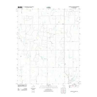
2013 Map of Elmore City North
USGS Topo · Published 2013About this map
Antioch serves as the primary community anchor in this portion of Garvin County, situated near the intersection of several section-line roads. The landscape is defined by the dendritic drainage patterns of Rush Cr and its tributaries, including Panther Cr and the eastern and western branches of Rock Creek. This rural topography is punctuated by Table Hill, a notable rise that stands apart from the surrounding creek valleys.
Find a feature on this map
26 named features on this map. Tap any name to fly to it.
Don’t see what you’re looking for? This feature index may not catch every label — zoom into the map to look around manually.
Map Details
Editions of this 2013 Elmore City North Map
This is the sole edition of this map. No revisions or reprints were ever made.
Other maps of this area

1898 · Pauls Valley
USGS Topo · 1:125,000

1902 · Pauls Valley
USGS Topo · 1:125,000

1902 · Rush Springs
USGS Topo · 1:125,000

1957 · Ardmore
USGS Topo · 1:250,000

1963 · Ardmore
USGS Topo · 1:250,000

1965 · Maysville
USGS Topo · 1:24,000

1965 · Paoli
USGS Topo · 1:24,000

1966 · Lindsay
USGS Topo · 1:24,000

1969 · Hennepin
USGS Topo · 1:24,000
1969 · Elmore City NE
USGS Topo · 1:24,000