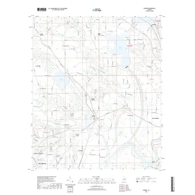
2018 Map of Elmore
USGS Topo · Published 2018About this map
Elmore and Coosada serve as central points in this Elmore County survey, where the Coosa River and Tallapoosa River converge near the ancient site of Taskigi Mound. The landscape is defined by its water systems, including the large R E 'Bob' Woodruff Reservoir and Speigner Lake, which feed into numerous tributaries like Mortar Cr and Coosada Cr. This modern edition reveals the sprawling residential growth of Millbrook and the outskirts of Wetumpka, showing how contemporary road networks such as Penny Pkwy and Politic RD have integrated with older community centers. Genealogists will find a high density of burial grounds, from the Ebenezer Cem in the north to Bibbs Cem in the south, preserving the location of family and church history amidst modern development like the Wetumpka Municipal Airport.
Find a feature on this map
162 named features on this map. Tap any name to fly to it.
Don’t see what you’re looking for? This feature index may not catch every label — zoom into the map to look around manually.
Map Details
Editions of this 2018 Elmore Map
This is the sole edition of this map. No revisions or reprints were ever made.
Other maps of this area

1901 · Wetumpka
USGS Topo · 1:125,000

1901 · Wetumpka
USGS Topo · 1:62,500

1903 · Wetumpka
USGS Topo · 1:125,000

1927 · Montgomery
USGS Topo · 1:48,000

1930 · Montgomery
USGS Topo · 1:62,500

1953 · Montgomery
USGS Topo · 1:250,000

1956 · Montgomery
USGS Topo · 1:250,000

1957 · Montgomery
USGS Topo · 1:250,000

1958 · Montgomery
USGS Topo · 1:62,500

1958 · Montgomery North
USGS Topo · 1:24,000