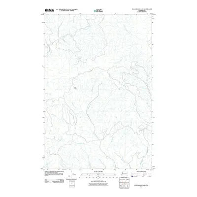
2011 Map of Elochoman Lake
USGS Topo · Published 2011About this map
Elochoman Lake sits at the hydrological heart of this upland region in Cowlitz County, where the headwaters of several significant drainages diverge. The drainage network is complex, featuring the westward-flowing Elochoman River and its East Fork, alongside the South Fork Chehalis River and Germany Creek. This landscape is defined by the legacy of the timber industry, evidenced by the extensive network of specialized routes such as Bradley Truck Rd, Wisconsin Truck Trl, and Incline Truck Trl. These names, along with the Incline Lookout, point to a history of active forest management and fire surveillance in the Pacific Northwest. The terrain is further etched by numerous named tributaries including Abernethy Creek, Mill Creek, and Cameron Creek, which carve through the high country south of the Chehalis watershed.
Find a feature on this map
25 named features on this map. Tap any name to fly to it.
Don’t see what you’re looking for? This feature index may not catch every label — zoom into the map to look around manually.
Map Details
Editions of this 2011 Elochoman Lake Map
This is the sole edition of this map. No revisions or reprints were ever made.
Other maps of this area

1919 · Mayger
USGS Topo · 1:62,500

1941 · Skamokawa
USGS Topo · 1:62,500

1941 · Clatskanie
USGS Topo · 1:62,500

1941 · Cathlamet
USGS Topo · 1:62,500

1952 · Clatskanie
USGS Topo · 1:62,500

1953 · Hoquiam
USGS Topo · 1:250,000

1953 · Ryderwood
USGS Topo · 1:62,500

1953 · Skamokawa
USGS Topo · 1:62,500

1953 · Cathlamet
USGS Topo · 1:62,500

1957 · Hoquiam
USGS Topo · 1:250,000