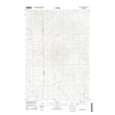
2013 Map of Elochoman Lake
USGS Topo · Published 2013About this map
The Wahkiakum Co and Cowlitz Co border runs through the heart of this timber-rich upland, where the headwaters of several major regional drainage systems diverge. High ridges are defined by the presence of Incline Lookout, marking a vantage point over the dense network of logging infrastructure like Wisconsin Truck Trl and Incline Truck Trl. This area serves as a critical hydrological divide where the E Fork Elochoman River flows westward toward the Columbia, while the S Fork Chehalis River begins its journey toward Grays Harbor to the north. Smaller tributaries such as Abernethy Cr and Mill Cr carve deep drainages through the territory, connected by specialized forest roads including Abernethy Creek Rd and Bradley Truck Rd. The presence of Elochoman Lake provides a rare still-water feature amidst the high-gradient streams and complex relief of the Pacific Northwest forest lands.
Find a feature on this map
31 named features on this map. Tap any name to fly to it.
Don’t see what you’re looking for? This feature index may not catch every label — zoom into the map to look around manually.
Map Details
Editions of this 2013 Elochoman Lake Map
This is the sole edition of this map. No revisions or reprints were ever made.
Other maps of this area

1919 · Mayger
USGS Topo · 1:62,500

1941 · Skamokawa
USGS Topo · 1:62,500

1941 · Clatskanie
USGS Topo · 1:62,500

1941 · Cathlamet
USGS Topo · 1:62,500

1952 · Clatskanie
USGS Topo · 1:62,500

1953 · Hoquiam
USGS Topo · 1:250,000

1953 · Ryderwood
USGS Topo · 1:62,500

1953 · Skamokawa
USGS Topo · 1:62,500

1953 · Cathlamet
USGS Topo · 1:62,500

1957 · Hoquiam
USGS Topo · 1:250,000