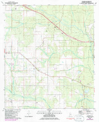
1980 Map of Elsanor
USGS Topo · Published 1985About this map
The Styx River and the Blackwater River define the winding drainage patterns of this Baldwin County landscape, captured during a period of agricultural and residential development in the 1980s. The settlement of Elsanor serves as a central hub, supported by the Elsanor Community Center and the Elsanor Sch. Local history is anchored by several rural congregations and burial grounds, including St. Matthew Ch, Seminole Ch, and Greenwood Ch, along with Foley Cem and the Greek Cem.
Find a feature on this map
23 named features on this map. Tap any name to fly to it.
Don’t see what you’re looking for? This feature index may not catch every label — zoom into the map to look around manually.
Map Details
Editions of this 1980 Elsanor Map
3 editions found
Other maps of this area

1920 · Robertsdale
USGS Topo · 1:62,500

1921 · Bon Secour
USGS Topo · 1:62,500

1921 · Fort Barrancas
USGS Topo · 1:62,500

1921 · Muscogee
USGS Topo · 1:62,500

1941 · Fort Barrancas
USGS Topo · 1:62,500

1941 · Muscogee
USGS Topo · 1:62,500

1941 · Robertsdale
USGS Topo · 1:62,500

1941 · Foley
USGS Topo · 1:62,500

1943 · Robertsdale
USGS Topo · 1:62,500

1943 · Muscogee
USGS Topo · 1:62,500