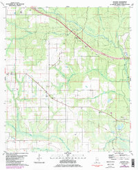
1980 Map of Elsanor
USGS Topo · Published 1985About this map
The Styx River and Blackwater River systems define the low-lying coastal plain of Baldwin County in this mid-1980s revision. Centered on the settlement of Elsanor, the landscape reveals a quiet community structured around institutional landmarks such as Elsanor Sch, the Elsanor Community Center, and St Matthew Ch. The presence of numerous claypits scattered across the township suggests an economy tied to local mineral extraction, while the Seminole Lookout Tower indicates the importance of forest management in the surrounding pine lands.
Find a feature on this map
28 named features on this map. Tap any name to fly to it.
Don’t see what you’re looking for? This feature index may not catch every label — zoom into the map to look around manually.
Map Details
Editions of this 1980 Elsanor Map
3 editions found
Other maps of this area

1920 · Robertsdale
USGS Topo · 1:62,500

1921 · Bon Secour
USGS Topo · 1:62,500

1921 · Fort Barrancas
USGS Topo · 1:62,500

1921 · Muscogee
USGS Topo · 1:62,500

1941 · Fort Barrancas
USGS Topo · 1:62,500

1941 · Muscogee
USGS Topo · 1:62,500

1941 · Robertsdale
USGS Topo · 1:62,500

1941 · Foley
USGS Topo · 1:62,500

1943 · Robertsdale
USGS Topo · 1:62,500

1943 · Muscogee
USGS Topo · 1:62,500