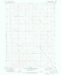
1973 Map of Elsie NE
USGS Topo · Published 1977About this map
Red Willow Creek winds through this section of Perkins County, defining the drainage patterns of an otherwise arid agricultural landscape. The 1973 survey data reveals a territory primarily organized by Section, Township, and Range lines, with a sparse distribution of cultural landmarks. A significant genealogical and historical point of interest is Walpole Cem, situated north of the creek. The map also records mid-century infrastructure developments, such as a large Pipeline traversing the center of the quadrangle and a Radio Tower positioned on a high point in the northeast. Small ponds and numerous wells scattered across the terrain indicate the critical importance of water management for the homesteads and farms operating in this portion of western Nebraska.
Find a feature on this map
4 named features on this map. Tap any name to fly to it.
Don’t see what you’re looking for? This feature index may not catch every label — zoom into the map to look around manually.
Map Details
Editions of this 1973 Elsie NE Map
This is the sole edition of this map. No revisions or reprints were ever made.
Other maps of this area

1898 · Paxton
USGS Topo · 1:125,000

1901 · Paxton
USGS Topo · 1:125,000

1954 · McCook
USGS Topo · 1:250,000

1954 · North Platte
USGS Topo · 1:250,000

1956 · North Platte
USGS Topo · 1:250,000

1957 · North Platte
USGS Topo · 1:250,000

1957 · McCook
USGS Topo · 1:250,000

1958 · McCook
USGS Topo · 1:250,000

1967 · North Platte
USGS Topo · 1:250,000

1971 · Sutherland Reservoir West
USGS Topo · 1:24,000