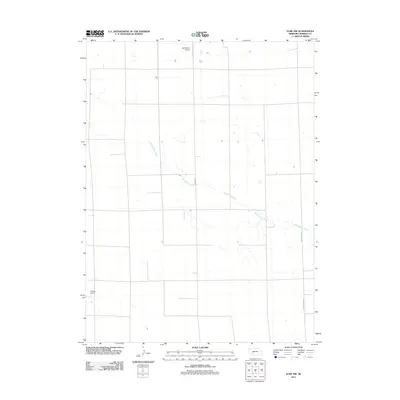
2011 Map of Elsie NW
USGS Topo · Published 2011About this map
Red Willow Creek meanders diagonally across this corner of Perkins County, defining the primary drainage for an otherwise strictly organized agricultural landscape. The region is marked by a rigorous section-line road grid, characteristic of the High Plains, where transit is dictated by the Public Land Survey System. Two private aviation facilities, Holzfasters Airport in the north and Jantzen Airport in the southwest, indicate the role of light aircraft in managing these expansive farming operations. Primary north-south transit follows the Elsie Paxton Rd, which also appears as the Paxton-Elsie Rd, linking local producers to the broader regional transportation network. The sparse concentration of named landmarks underscores the specialized rural nature of this territory in the early 21st century.
Find a feature on this map
5 named features on this map. Tap any name to fly to it.
Don’t see what you’re looking for? This feature index may not catch every label — zoom into the map to look around manually.
Map Details
Editions of this 2011 Elsie NW Map
This is the sole edition of this map. No revisions or reprints were ever made.
Other maps of this area
1897 · Ogallala
USGS Topo · 1:125,000
1898 · Paxton
USGS Topo · 1:125,000
1900 · Ogallala
USGS Topo · 1:125,000
1901 · Paxton
USGS Topo · 1:125,000

1954 · McCook
USGS Topo · 1:250,000

1954 · North Platte
USGS Topo · 1:250,000

1956 · North Platte
USGS Topo · 1:250,000

1957 · North Platte
USGS Topo · 1:250,000

1957 · McCook
USGS Topo · 1:250,000

1958 · McCook
USGS Topo · 1:250,000