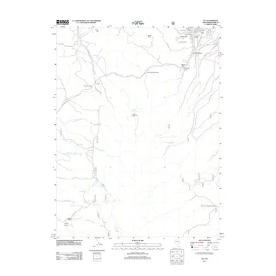
2012 Map of Ely
USGS Topo · Published 2012About this map
Ely serves as the primary hub of this high-desert landscape, where the town's street grid meets the complex topography of the Egan Range. Transportation routes such as Ely Junction and the winding path to Murry Summit illustrate the challenges of navigating this terrain. The map documents a blend of recreation and local landmarks, featuring the Ward Mountain Ski Hill and the distinctive Landmark Letters overlooking the community. Drainage systems and seasonal water sources define the outlying areas, with named washes like Dead Horse Wash and Lion Spring Wash cutting through the canyons. Notable elevations and geologic features like Fossil Hill, Saxton Peak, and The Big Bluff dominate the horizon, while numerous localized springs, including Murry Springs and Ice Plant Spring, provide critical water points in an otherwise arid environment.
Find a feature on this map
49 named features on this map. Tap any name to fly to it.
Don’t see what you’re looking for? This feature index may not catch every label — zoom into the map to look around manually.
Map Details
Editions of this 2012 Ely Map
This is the sole edition of this map. No revisions or reprints were ever made.
Other maps of this area

1952 · Ely
USGS Topo · 1:125,000

1956 · Ely
USGS Topo · 1:250,000

1958 · Ruth
USGS Topo · 1:24,000

1958 · East Ely
USGS Topo · 1:24,000

1958 · Comins Lake
USGS Topo · 1:24,000

1958 · Ely
USGS Topo · 1:62,500

1958 · McGill
USGS Topo · 1:62,500

1958 · Reipetown
USGS Topo · 1:24,000

1958 · Giroux Wash
USGS Topo · 1:24,000

1958 · Ely
USGS Topo · 1:24,000