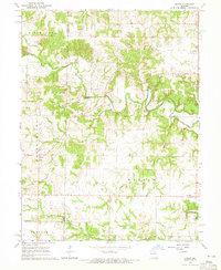
1964 Map of Emden
USGS Topo · Published 1965About this map
The North River meanders across this rural landscape on the border of Shelby and Marion counties, defining a region where small-town life centered on crossroads settlements and country congregations. In the mid-1960s, the village of Emden served as a local hub, featuring the Emden Sch and the Emden Grange Park, indicating a community deeply rooted in agricultural social structures. To the east, the small settlement of Warren sits near the winding Hawkins Branch.
Find a feature on this map
20 named features on this map. Tap any name to fly to it.
Don’t see what you’re looking for? This feature index may not catch every label — zoom into the map to look around manually.
Map Details
Editions of this 1964 Emden Map
2 editions found
Other maps of this area

1903 · Palmyra
USGS Topo · 1:125,000

1948 · Quincy
USGS Topo · 1:250,000

1949 · Durham
USGS Topo · 1:24,000

1949 · Philadelphia
USGS Topo · 1:24,000

1950 · Durham
USGS Topo · 1:24,000

1950 · Philadelphia
USGS Topo · 1:24,000

1956 · Quincy
USGS Topo · 1:250,000

1959 · Monroe City
USGS Topo · 1:24,000

1959 · Lakenan
USGS Topo · 1:24,000

1959 · Hunnewell
USGS Topo · 1:24,000