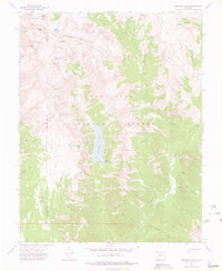
1973 Map of Emerald Lake
USGS Topo · Published 1976About this map
San Juan National Forest encompasses this high-altitude landscape in the 1970s, where the Emerald Lake basin serves as a central hydrological landmark. The map details a complex drainage system feeding into the Los Pinos River, including numerous alpine catchments such as Lake Mary Alice, the Flint Lakes, and Little Emerald Lake. The terrain is characterized by dramatic elevation changes, from the heights of Mount Oso and Peters Peak to the deep depressions of Hell Canyon.
Find a feature on this map
34 named features on this map. Tap any name to fly to it.
Don’t see what you’re looking for? This feature index may not catch every label — zoom into the map to look around manually.
Map Details
Editions of this 1973 Emerald Lake Map
4 editions found
Other maps of this area

1900 · Needle Mountains
USGS Topo · 1:62,500

1902 · Needle Mountains
USGS Topo · 1:62,500

1905 · San Cristobal
USGS Topo · 1:125,000

1907 · San Cristobal
USGS Topo · 1:125,000

1908 · Ignacio
USGS Topo · 1:125,000

1924 · Ignacio
USGS Topo · 1:125,000

1924 · Pagosa Springs
USGS Topo · 1:125,000

1927 · Pagosa Springs
USGS Topo · 1:125,000

1945 · Durango
USGS Topo · 1:250,000

1953 · Durango
USGS Topo · 1:250,000